Bus stop location wrong (Sir Ludwig Guttmann Health Centre)

I note that both Google and TfL have this bus stop (Q) in the wrong place.

It’s actually by the bus shelter, which is marked on the map.

I cross check in Google satellite maps and you can see both the shelter and the stop (purple arrow) and the words “BUS STOP” too!

When someone has a moment, could this be fixed?

1 Like

Hi @briantist

I’ve had a look at the source data for this bus stop and compared the co-ordinates, both this and the stop data used in Journey Planner (and in turn Google) match. I’ll ask the team at Buses to check this.

Regards
Matthew (cc @GerardButler for reference)

2 Likes

Thanks.

I know it’s only a short distance but it makes the journey planning think that it’s better to walk to the next stop!

B

1 Like

Good evening @briantist & @MScanlon :slight_smile:
@MScanlon Also can you get the team to look at these stops that are very wrong please for 223,326,384
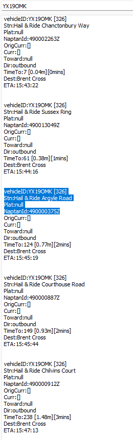
images below
Stops are:
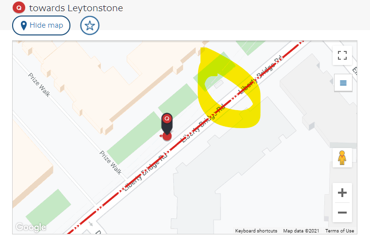
Montpelier Rise for 223
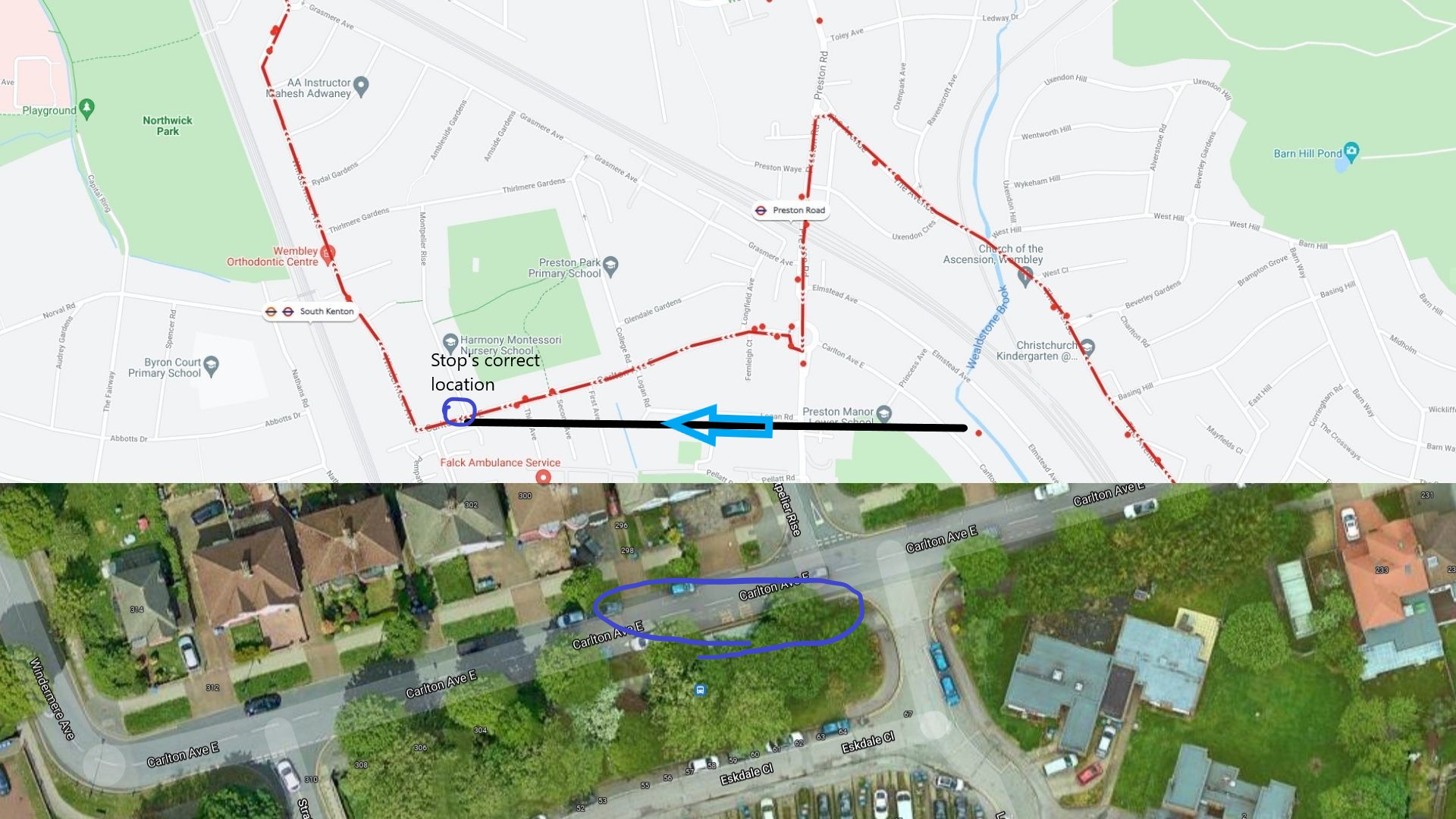
Holbrook way willow court which is really should argle road and tillingham way for 326
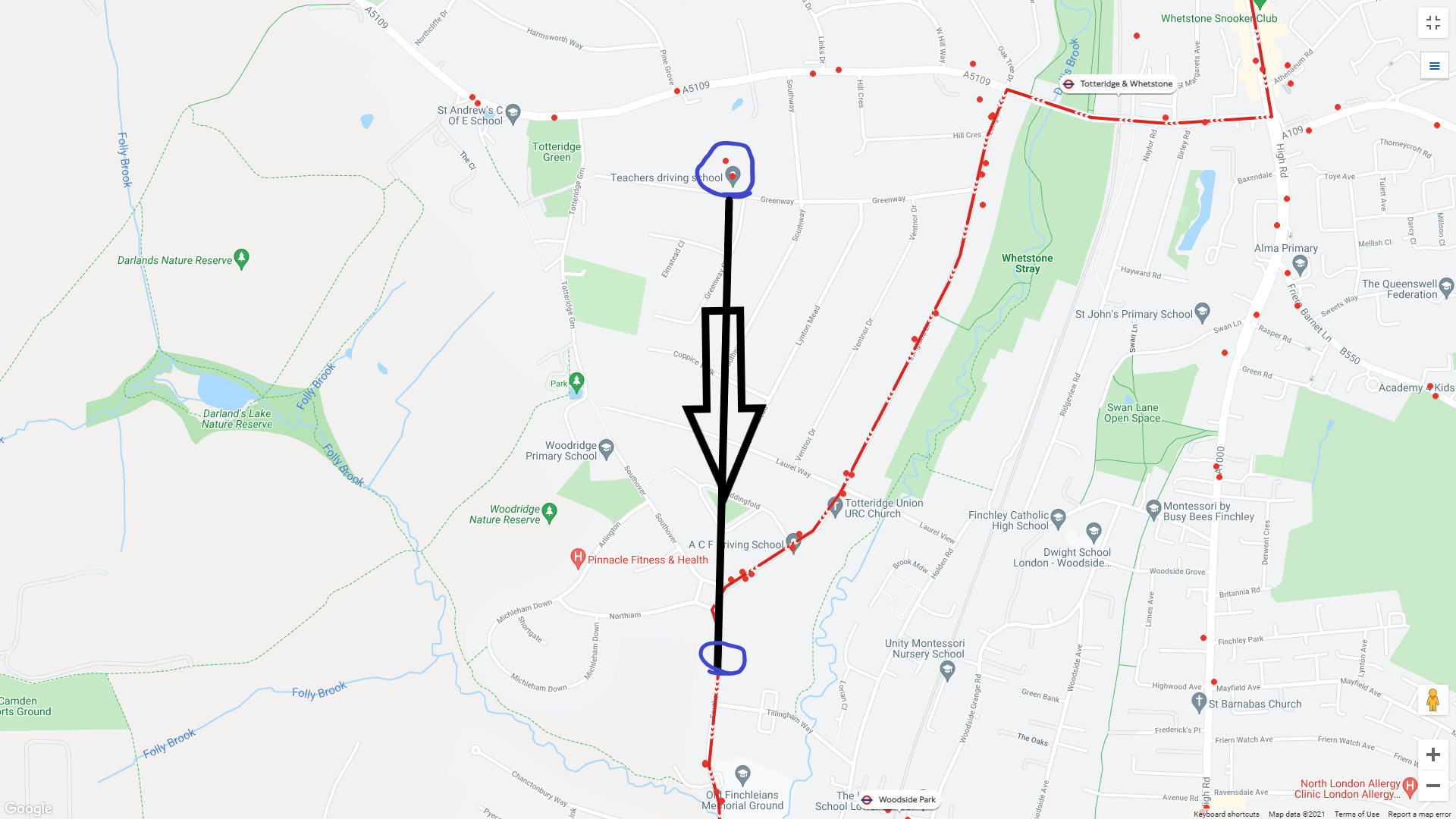
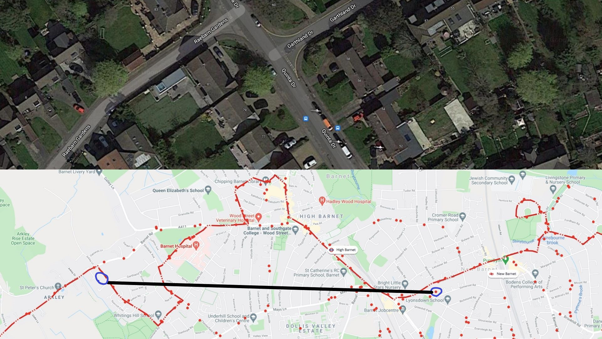
Garthlard drive for 384


Many Thanks,
Anas

1 Like

Perhaps you might be able to get the Naptan stop codes? Mine was 490000287N but it got translated to a web link.

1 Like

Hello @briantist
223: Montpelier Rise 490001986Z
326: Tillingham Way 490002260Z and 490002260Y
326: Holbrook Way Williow Court 490000375Z which should be Argle Road
384: Garthlard Drive 490020353W

Hi @Ajebz

These have all been corrected now.

Regards
Matthew ( cc @GerardButler for reference)

1 Like

Afternoon @MScanlon
Thank you :slight_smile: , will they be published in next week’s data bulid or at some point?

Many Thanks,
Anas

Was the Guttmann stop done too?

1 Like

@briantist

I haven’t seen any changes yet actually for any.

1 Like

They should be the API tomorrow and in the TxC and NaPTAN dataset next week

2 Likes

Hi @briantist I’m still awaiting a response from London Buses regarding this, as from the data we have and have been provided the stop is in the correct place.

Regards
Matthew

1 Like

Thank you @MScanlon
Much appreciated
:slight_smile:
Many Thanks
Anas

1 Like

It seems that there is a somewhat lax definition here of “correct”. :slight_smile:

1 Like

Hi @briantist

I’ve finally had an update from the team at London Buses who look after the stop locations who can confirm that the co-ordinates provided were incorrect, this stems from when the stop was orginally planned with no access to the road at the time, this has now been updated in all systems so should be live later today.

1 Like

@MScanlon

Thanks. That’s a wonderful Xmas present!

1 Like

Evening @MScanlon
Any news yet for stop "Sir Ludwig Guttmann Health Centre " and “Argyle Road” for 339 & 326?

Thanks,
Anas

Hi @Ajebz these stops are correct in our data, and should be correct in the API, where are you seeing that these are incorrect/

Regards
Matthew ( cc @GerardButler )

1 Like

Hi @MScanlon


https://api.tfl.gov.uk/stoppoint/490000375Z/arrivals
The name of the stop in the tfl is wrong + location. At the moment the stop is called Holbrook Way Willow court, but in the iBus/ API arrivals the stop name is Argyle Road in the API.
I ain’t too sure for sir ludwig guttmann health centre with regards to positioning
Also it refers to stops for B13 and 192 here : Bus API status/Route sequences (For Journey Planner Team) - #43 by Ajebz
i hope that helps
Thanks,
Anas

Hi @Ajebz

This looks to be from the Countdown data which is maintained by another team and not the Journey Planner team. @jamesevans or @neamanshafiq are you able to provide assistance with this?

Regards
Matthew

1 Like