Hi there,
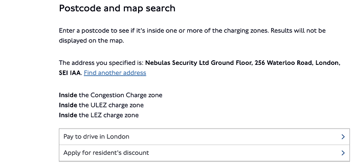
We are developing a new site and we would like some help to find an api which provides a response to see if a certain location falls within the ULEZ and/or the Congestion Zone. An example if seen in the link below and screenshot from Tfl site.
Hello and welcome to the forum!
Unfortunately, I don’t think we provide a public API to check whether a given location falls within those zones.
We do, however, provide JSON and Shape files for the zones as open data:
Please be aware that the ULEZ will be expanding across all London boroughs from 29 August 2023:
NR14
September 6, 2023, 2:41pm
3
Hi Leon,
Any idea when the new ULEZ expansion data will be available as json and shape files? Appears that the official files are pre-August 29th expansion?
Hello, thank you for your query.
A shapefile of the expanded ULEZ boundary is available from the London Datastore:
https://data.london.gov.uk/dataset/london-wide-ultra-low-emission-zone-expansion-2023
SarahLS
September 21, 2023, 12:27pm
5
Just to note - the ULEZ boundary Shape files have now been updated on our Roads Open Data page
