[Mission 1] Calculating Distances between ALL Underground Stations for ALL Lines
Criteria:
- Data must be provided in a digital format such as CSV or XML; no scanned PDFs or hard copies
- Additional points awarded for a fully developed browser-based solution with dropdown capabilities. i.e solution could enable users to select their desired start and end stations and receive the overall distance between them.
Good Luck!
Welcome @SDFXP07
Been there, done that!
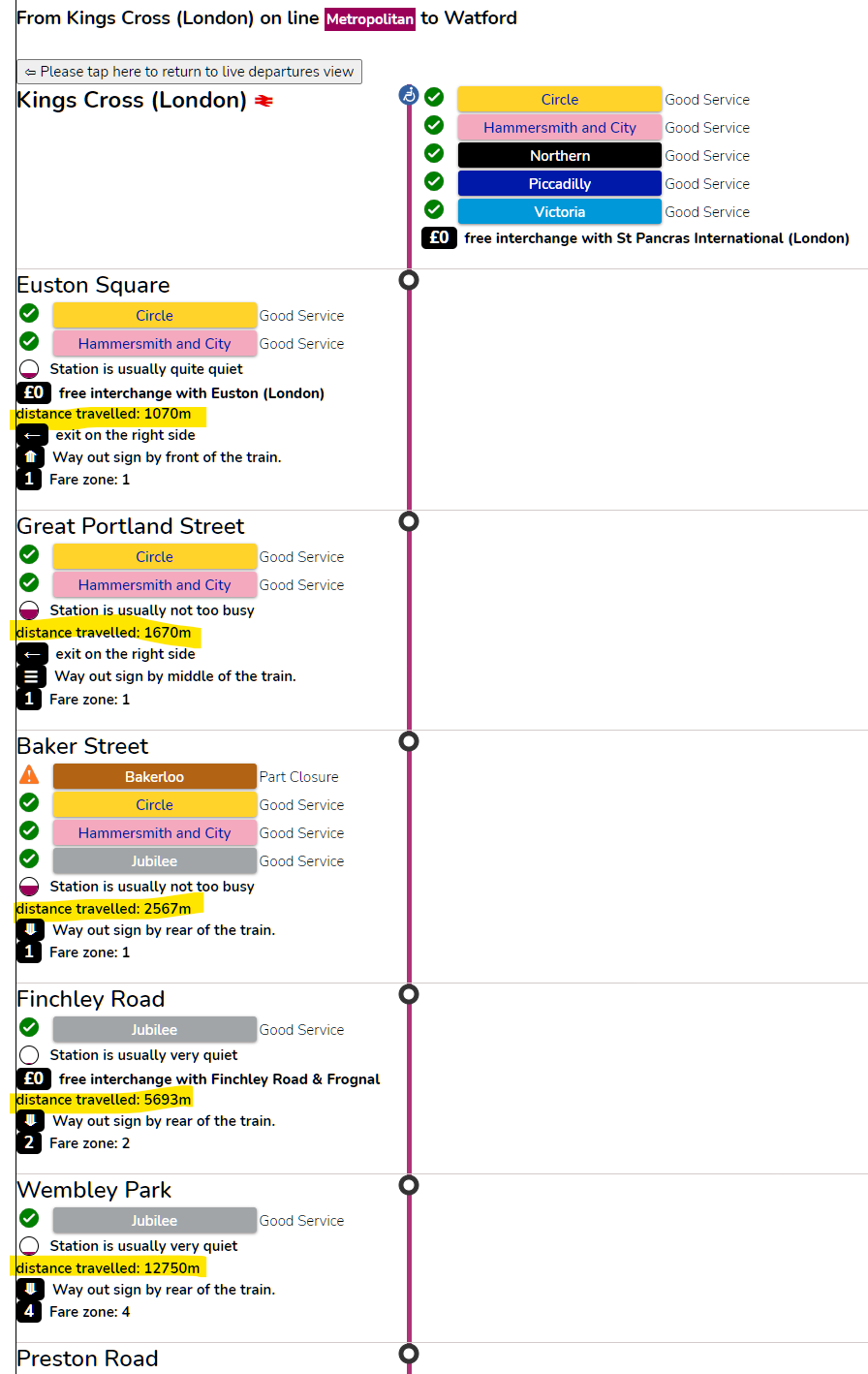
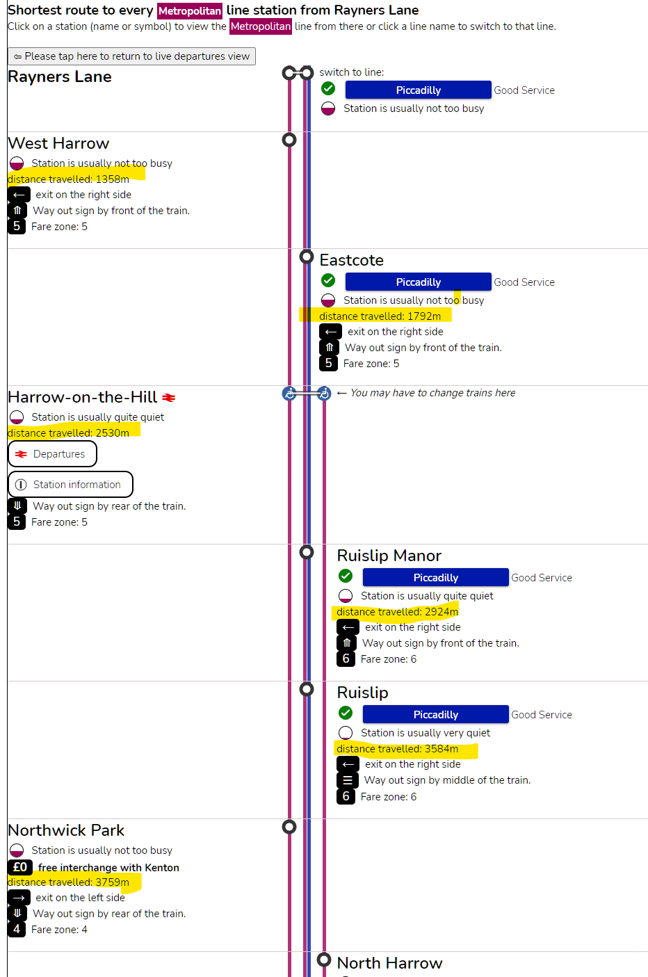
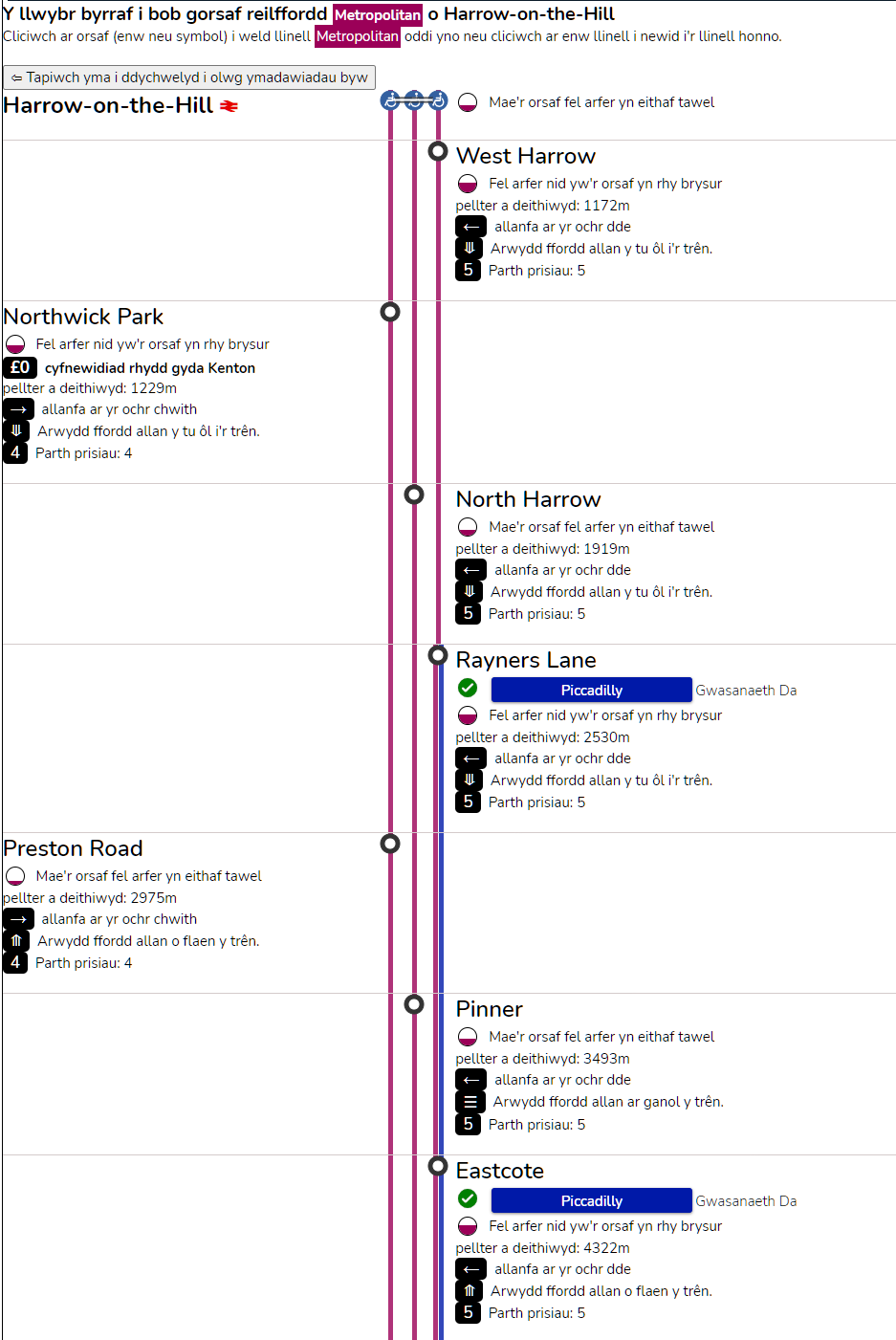
https://rti2-demo.whoosh.media/json/tubemap
enjoy. It’s JSON and a directed-graph
It’s got the Overground and Thameslink as well as the DLR and trams.
The interface works fine is still being waiting approval for public use as my CSS skills aren’t up to the professional designers I work with.
Or when it says “check front of train” the whole network is shown…
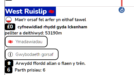
And for Welsh speakers out there…
Not sure if Uxbridge to Cockfosters is the longest
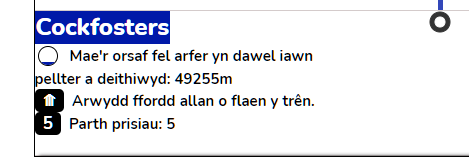
longer than Amersham to Aldgate
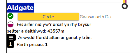
Epping to West Ruislip is very long!
1 Like
@briantist Wyt ti wedi creu app yn Gymraeg?